 Washington (Mt. St. Helens)
Washington (Mt. St. Helens)
|
|
Previous Page | Next Page |
Thank you so much to Ken Guthrie of Cougar, WA
Starting on September 13, 2002, 12:19:06 PM
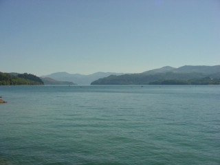
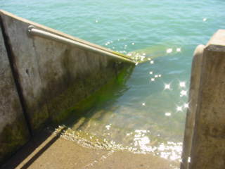
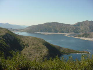
One more night in Olympia and I was off to take a trip through the Mt. St. Helens volcanic area. At first I headed down Interstate 5 to hwy. 12 east. I stopped and got these images of Riffe Lake at the Mossy Rock Dam. I thought these stairs, leading right into the lake, were quite interesting and wondered who might be using them and how far down they went, and why.
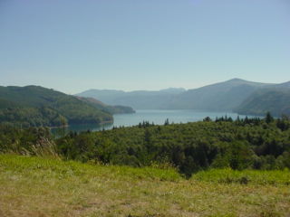
Up around the corner I saw a sign that lead me up a small highway to a Mt. St. Helens lookout point. From the top of the vantage point, 24 miles from the crater, all I could see was the very top of the peak.
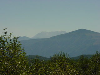
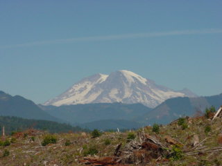
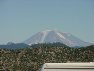
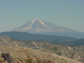
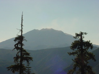
I drove on further towards the mountain and got this picture of Mt. St. Adams to the east of St. Helens.

The drive along hwy. 12 was a real nice ride.
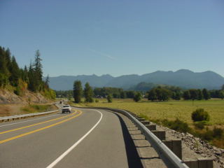
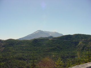
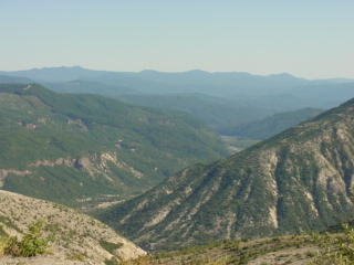
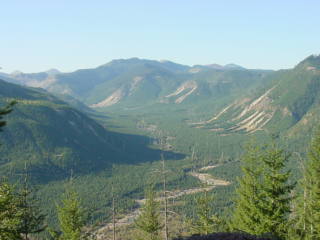
After I got to Randle, WA I took hwy 25 towards the St. Helens area. Along the way I was passed by several other guys on motorcycles. The ride along this hwy was a really awesome ride for a motorcycle. With lots of winding turns it made for a wonderful ride. Climbing up in altitude I was able to see some beautiful shots of Mt. Rainier as well. Here you can also see a little bit more of some of the logging that seems to be a large part of the livelihood in this area.
A Sleeping Giant
On May 18, 1980 Mt. St. Helens erupted in a violent upheaval that took more than 1,300 feet off the total elevation of this once silent giant. Volcanic ash and steam was sent more than 15 miles up into the air and blanketed parts of Washington state for hundreds of miles and devastated the whole area around the mountain. Pyroclastic flows tore down the mountain and shredded anything in its path for miles. Pumice and mud flows filled local rivers and streams, causing major floods for hundreds of miles downstream and changed the shape of the landscape forever. The initial blast took many lives and changed the lives of others for many years to come.
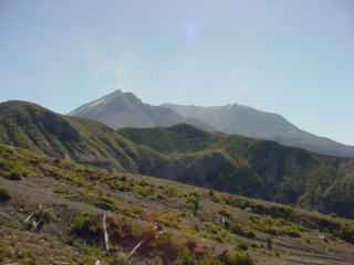
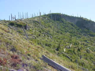
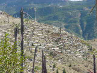
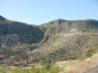
Now, still, more than 20 years later, the area around the mountain still looks much like it did back then. The landscape still displays many of the shredded trees along the neighboring hillsides and still shows so much of the devastation that radically changed this area.
I was living in Oregon at the time of the eruption, about 100 miles away. We were upwind from the mountain but did get some very light deposits of fine ash and dust that managed to get caught in the far upper winds of the stratosphere. I had made a trip to the mountain back in 1992 where my friend Ken gave me a ride up and around the area in one of his helicopters. It still looks much like it did back then. Sure, there's quite a bit of growth and vegetation but the area still looks quite devastated even today.
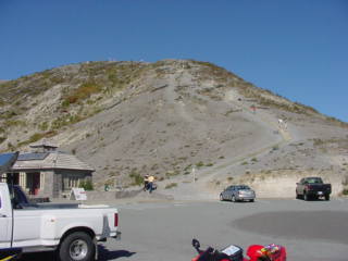
As I got closer to the mountain I took the forestry development road #99 that leads right up to the foot of the mountain itself. I had stopped at a visitor center not far from the mountain and got some shots there as well.
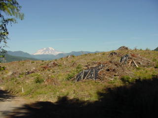
There from the parking lot I could still see the neighboring peak, Mt St. Adams and was compelled to take more pictures.
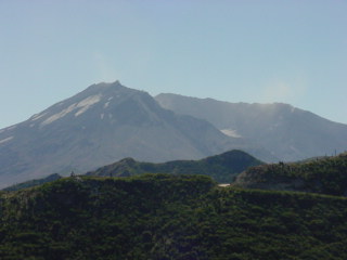
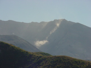
Dust and ash from the mountain kept blowing up from the crater, giving the monster the illusion that the volcano was still quite active. However, I was told, the mountain does still tend to throw up steam from the lava dome from time to time.
The road ended up at a parking area and a long stairway that lead up to the top of the nearby observation deck.
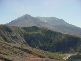
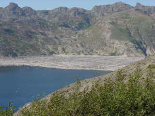
From this observation deck I could see the mountain and crater from an awesome vantage point. Also in clear view was spirit lake and all the logs, still floating in the water.
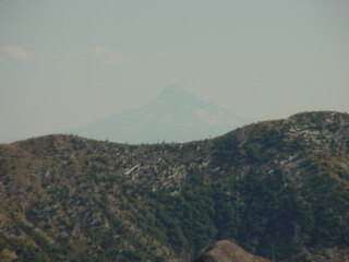
Another view and angle of St. Adams from the observation peak and the next image shows, very faintly, through the haze, Mt. Hood in Oregon.
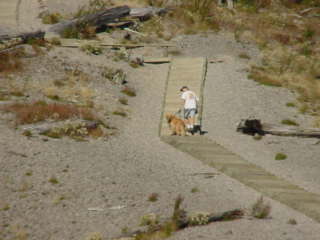
After my hike up the stairs I came back down and met some guys. We all got quite a good laugh at the guy taking his dog up the long stairs to the observation deck. The dog, on a leash, kept turning around and looking down the hill to the parking lot. They would walk a little further and the dog, you could tell, didn't really want to go. He kept looking back as if longing to go back down.
A closer image of some of the dust and ash blowing up from the landslide in the crater.
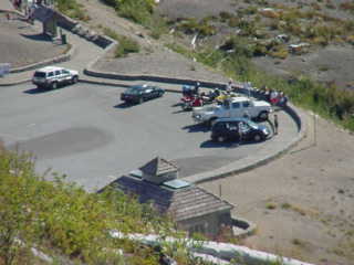
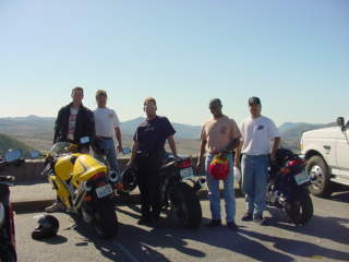
Here's a group of the guys I met up there. They were all enjoying the great weather and ride on this wonderful Friday the 13th.
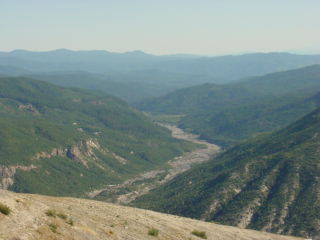
Coming back down the hill gave me some more interesting views of the surrounding area.
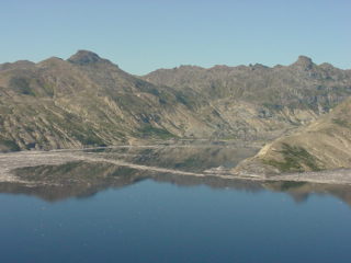
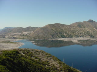
Another angle of Spirit Lake from the back side shows the thousands of logs still floating in the water. Remnants from the eruption in 1980, these logs float around the lake and change their location from time to time as the wind blows.
Along the hill sides I watched the dead tree trunks. The further away from ground zero the taller the trunks and eventually to the point where there were even real trees.
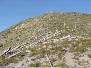
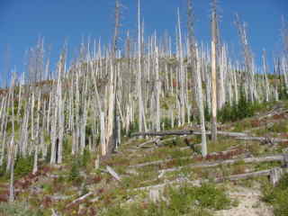
Totally splintered by the blast, these enormous trees were all flattened as if they were simply toothpicks.

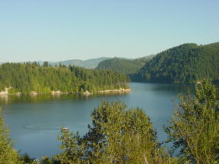
Back onto hwy. 25 I headed further south towards Cougar, WA. From a few view points on the neighboring hills I could see the east side of the mountain where it actually still looked like a mountain. Then, as I descended below I could no longer see the volcano and dropped down to the Swift Reservoir and hwy. 503 down into Cougar.
Upon arrival into Cougar I was surprised when I didn't see any helicopters at my friend Ken's place. I later found out that he had sold all his helicopters including the first one that we had rebuilt in our garage.
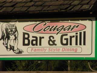
While in Cougar I stopped at this small town Bar and Grill and though it an interesting name for a restaurant and bar. The term, "Family" is what I found the most amusing. I don't know about you all, but I think that I would probably feel a little uncomfortable taking my family and children to the local bar.
|
|
Previous Page | Next Page |

Copyright © 2002 Galixy Productions, Galixy.net. All rights reserved.